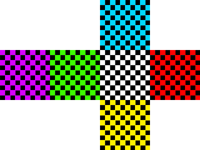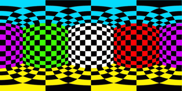

ncmerge can combine cell-based irregular grids very quickly into a single equirectangular (Plate Carree) grid to simplify visualization workflows. It first creates a map file from coordinate grids, and then performs fast lookups when regridding data values. 3D time varying variables are supported.
# Create map file once for all the coordinates.
GRIDS=1.nc,2.nc,3.nc,4.nc,5.nc,6.nc
ncmerge --map map.nc --eta --near 4 --grids $GRIDS --cells --gridvars xt,yt --nx 400 --ny 200

# Progress output.
# Done |  Elapsed | Remaining |  Processed | Unprocessed | Rate
# 100% | 00:00:00 |  00:00:00 | 80,000 pts |       0 pts | 685,365 pts/s

# Regrid the values.
ncmerge --map map.nc --tiles $GRIDS --var data -o regridded.nc

Figure 1. Original grids from 6 cubed sphere tiles.

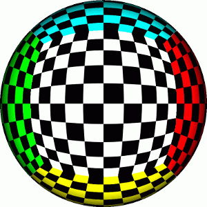
Figure 2. Tiles visualized on a 3D sphere.

Figure 3. Tiles regridded onto unified grid by ncmerge.
# After adjusting Makefile.inc.
make
make test
make install
make clean
v0.0.0 2012/10/19
make html
make dist VER=0.0.0
ssh -t rsz,ncmerge@shell.sourceforge.net create
scp html/* rsz,ncmerge@shell.sourceforge.net:/home/project-web/ncmerge/htdocs
scp ../ncmerge-0.0.0.tar.gz rsz,ncmerge@shell.sourceforge.net:/home/frs/project/p/py/ncmerge
Copyright 2012 Remik Ziemlinski under the terms of the GNU General Public License v3